Nicht kategorisierte Dateien
Zur Navigation springen
Zur Suche springen
Unten werden bis zu 50 Ergebnisse im Bereich 1'701 bis 1'750 angezeigt.
 Gegm3.jpg 1'104 × 677; 341 KB
 Gegm4.jpg 1'103 × 674; 222 KB
 Gegm5.jpg 1'101 × 675; 124 KB
 Gegm6.jpg 1'104 × 675; 255 KB
 Gemeinde Rondchatel.jpg 515 × 339; 80 KB
 Gemeindenamen.jpg 412 × 229; 39 KB
 Gemeindenamen2.jpg 411 × 138; 9 KB
 Gemeindenamen n.jpg 420 × 140; 23 KB
 Gemeindenamen n2.jpg 315 × 210; 27 KB
 Geo-microformat-button.png 80 × 15; 737 Bytes
 Geo-microformat-extension-screenshot.JPG 320 × 240; 19 KB
 Geo-microformat-extension-screenshot.jpg 195 × 65; 3 KB
 GeoBeer-Shirts.jpg 1'022 × 472; 84 KB
 GeoBeer-logo.png 1'936 × 1'337; 160 KB
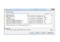
 GeoConverter V1.jpg 657 × 519; 167 KB
 GeoConverter V1.png 600 × 514; 164 KB
 GeoConverter V2.png 1'040 × 689; 45 KB
 GeoPython 2017 Workshop QGIS Python.zip ; 3,33 MB
 GeoSharing Abstimmung.PNG 1'012 × 706; 365 KB
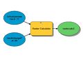
 Geo metadata architecture.PNG 524 × 349; 51 KB
 Geocaching TecDay@KZO.pdf ; 5,14 MB
 Geodatabase.jpg 342 × 203; 63 KB
 Geodesign framework.JPG 1'441 × 1'079; 228 KB
 Geografie der Schweiz.jpg 219 × 168; 7 KB
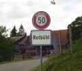
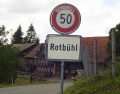 GeografischeNamen Ortstafel Rotbuehl.jpg 1'190 × 936; 99 KB
 GeografischeNamen Roopel Ortstafel.jpg 635 × 547; 75 KB
 Geografische Namen.jpg 1'817 × 1'237; 172 KB
 Geografische Namen 2.jpg 654 × 428; 49 KB
 Geografische Namen Einsatzleitzentrale.jpg 1'112 × 538; 128 KB
 Geografische Namen Wandderwegweiser.jpg 788 × 268; 56 KB
 Geography Quiz Example.png 480 × 800; 92 KB
- Geomatik Schweiz 7-8-2017 S258.pdf ; 130 KB
 Geometa.info.jpg 1'280 × 1'024; 133 KB
 Geometa info cube2.gif 20 × 18; 915 Bytes
 Geroldareal.JPG 1'010 × 582; 194 KB
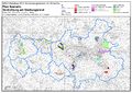
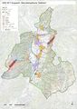 Gesamtkarte Gefahren.jpg 3'509 × 4'959; 15,66 MB
- Gesamtkarte Gefahren.pdf ; 6,77 MB
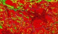
 Gewaesserpotenzial CAS2012.jpg 1'755 × 1'241; 1,28 MB
 Gewaesserpotenzial rotgruen CAS2012.jpg 1'755 × 1'241; 2,89 MB
 Gewichtung.png 472 × 218; 28 KB
 Gewichtung Armut.png 1'460 × 317; 23 KB
 Gewichtung Armut final.png 1'460 × 317; 23 KB
 Gewichtung klein.png 405 × 171; 28 KB
 Gis2013 grp1 Berechnung model.jpg 1'112 × 769; 124 KB
 Gis2013 grp1 Plan Szenario.jpg 3'509 × 2'481; 8,79 MB
 Gis2013 grp1 Plan Szenario333.jpg 3'509 × 2'481; 8,79 MB
 Gis2013 grp1 Variante Rechnerisch.jpg 866 × 612; 59 KB
 Gis2 2011 bewertbiodiv.JPG 1'771 × 1'038; 788 KB
 Gis2 2011 bewertgrp1.JPG 1'772 × 1'034; 680 KB


